|
floods |
|
|
In recent times, we have seen some high water, as shown by this June 2014 video. But nothing like those seen in the past. Read on to learn about some of the flooding that we used to experience, beginning with the floods of 1858 that sent almost all of the pioneers of "Table Rock City" to other places.
|
|
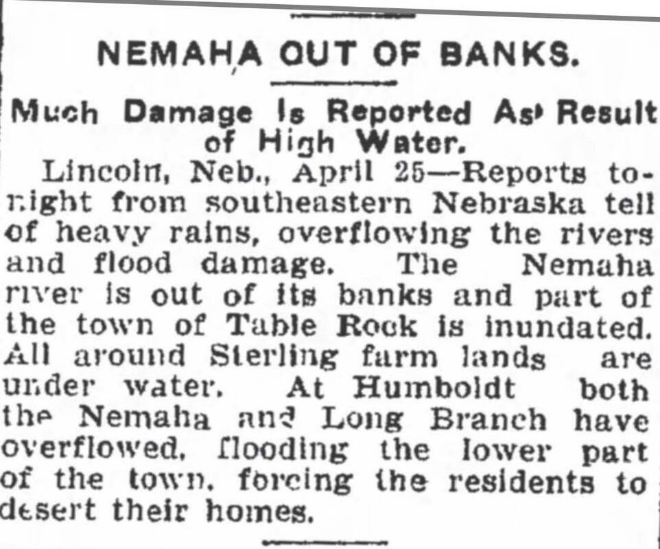
the nemaha river
1856 - flood impedes a sale of the town
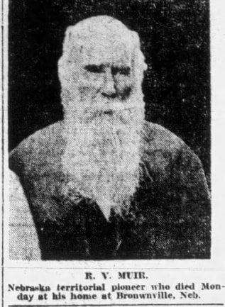
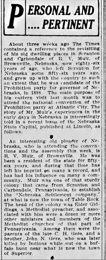
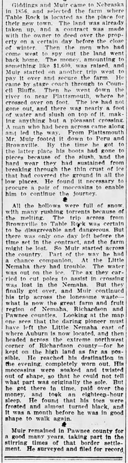
Floods and high water caused a dramatic struggle for Robert V. Muir of the Nebraska Settlement Company as he struggled, money in hand, to get back to the town site to complete a deal to purchase the land by the due date. Here is the story as compiled by Sharla Sitzman Cerra:
THE FOUNDING OF TABLE ROCK |
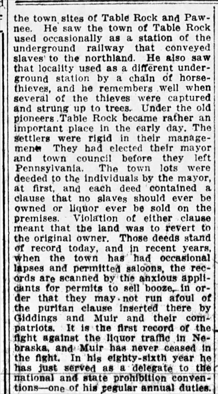
muir's story
A Pennsylvania newspaper reported Muir's story, gained when he visited there for a Prohibitionist conference. See “Personal and Pertinent,” Times-Tribune (Scranton, Pennsylvania), August 9, 1912, page 6.
|
At right: Muir photo from a wedding anniversary story that was included with his 1917 obituary. However, at the time of his 1856 journey, he was only 30 years old.
|
|
The part about his journey to Table Rock to put the money on the table is in the second section below:
1858 - FLOOD nearly wipes out early settlers
|
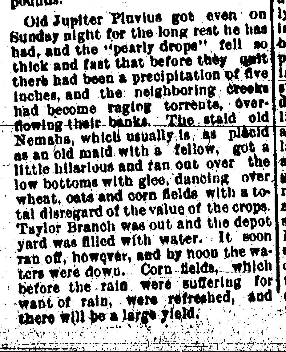
In 1856 and 1857, the first of the Settlement Company’s many families joined the few existing families. Many of the new families settled along the banks of the Nemaha, as well as Taylor Branch and Clear Creek. It probably seemed safe. The Nemaha here was once described, before it was straightened, as the “staid old Nemaha, which usually is as placid as an old maid with a fellow.” However, the old maid had a dark side. The Nemaha flooded kin 1858, creating not only destruction but death. The aftermath of the receding flood waters was disease, and many became critically ill and many died. Table Rock itself not flooded but it was virtually wiped out as a consequence of the floods.
The story as told by Sharla Sitzman Cerra in an application for Underground Railroad Network to Freedom listing of the Table Rock Cemetery compiles diaries from local settlers and other information. A fully footnoted versionis at the Network to Freedom application link at right: |
It was difficult coming to this new country, trying to farm land that had never been farmed, living in a small log house with cracks “big enough to throw a cat through,” as settler Lydia Griffing later described it, having no trained medical care, having to figure out how to institute everything from a school for the children to church. The difficult life became more difficult when the “Panic of 1857” dried up funding for the Nebraska Settlement Company; banks failed, and cash was scarce. The weather, too, was hard on the settlers. The winter of 1857-8 was severe and then the spring and summer of 1858 brought floods that wiped out homes and farms. One of the settlers of 1857, Juliana Gere, wrote in her journal that they had a “fine prospect” for an abundant vegetable crop, but then the river flooded. Covering their garden under several feet of water. “Many acres” of bottomland were under water, all of the bridges on creeks and rivers had been carried away, the mill dams washed out, and homes leaking. C. W. Giddings described the high water, saying that the Nemaha River valley “was inundated, and the cultivated lands, being on the bottoms, and the cabins of the settlers on the banks of the streams, much damage was done and great suffering prevailed.” |
more references
1876 - Lower town HOUSES and "fat" hogs CARRIED AWAY
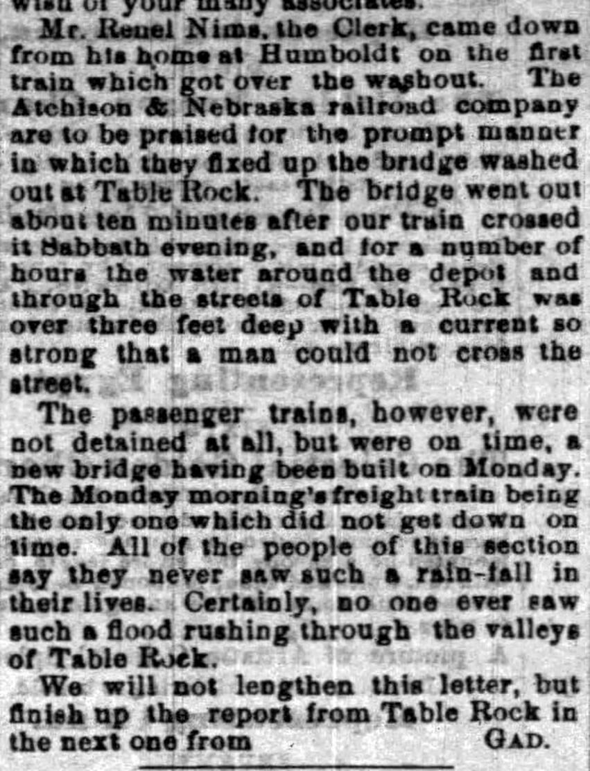
May 11, 1876 Nebraska State Journal --Lower town submerged, houses carried away.
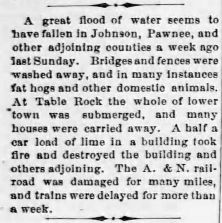
From the August 26, 1876 Nebraska State Journal, a railroad bridge falls victim to the flood waters. The streets of Table Rock are covered by three feet of water with a current so swift no man could stand in it. Obviously they considered Table Rock to be the Railroad Addition of Table Rock near the depot.
1880 - Flood starts fire
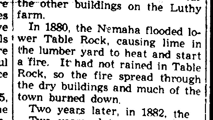
1880-ish
The railroad drew the residents of Table Rock to the Railroad Addition, "Lower Town." As recounted in the 1882 tome of history and biographies by Andreas:
At times, it seemed as if the upper town would be deserted. The low land, however, was so subject to floods that the citizens came to the conclusion that the old site was the best, and, two years ago, a paper was extensively signed by them, agreeing to remove their buildings and their business interests to the upper town. All except a few houses did so.
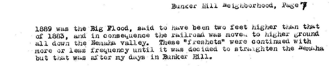
1889 - railroad elevated because of floods
This is from a 1934 history of the Bunker Hill neighborhood by Elsie Pepoon.
1897
flood waters hit railroad between table rock and humboldt
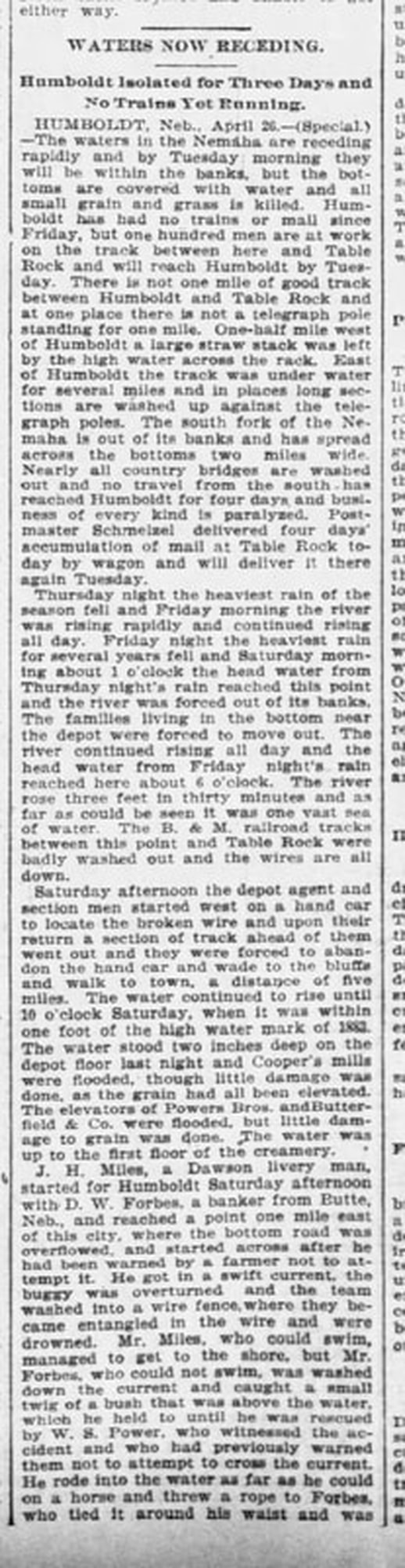
April 17, 1897 Nebraska State Journal
1898
the a & N railroad changed the course of its rail lines to deal with long time flooding problems
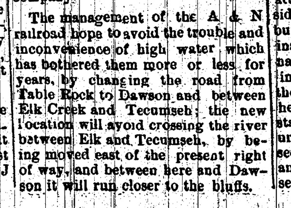
June 16, 1898
1900 -- a poetic description of the flooding
July 19, 1900 Argus
1902
June 10, 1902 Lincoln Journal Star
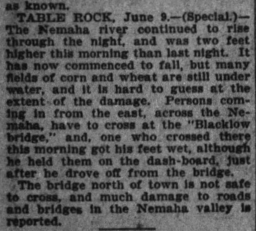
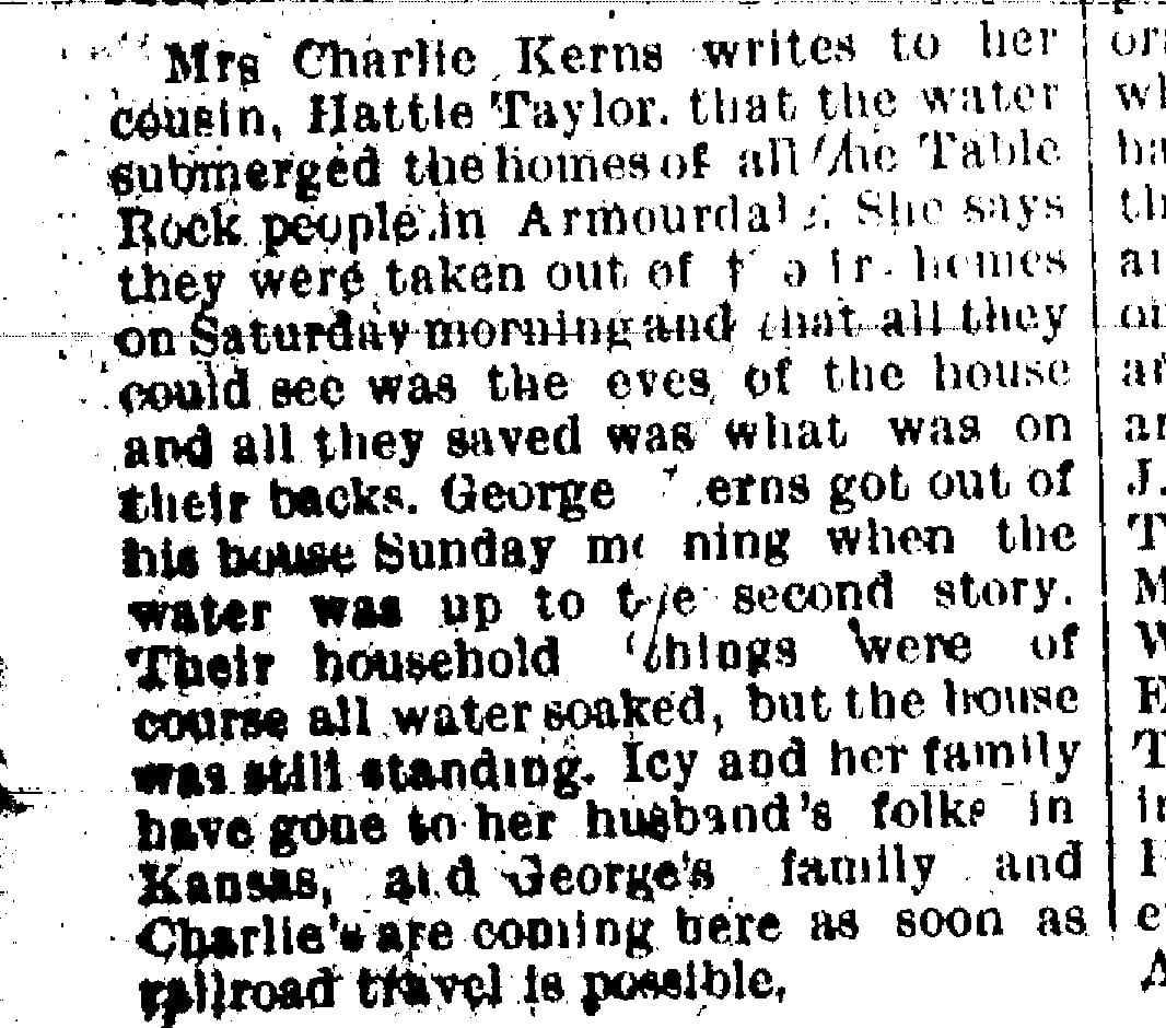
1903 - flood not in table rock but affects table rock people
This June 11, 1903 article speaks of flooding in the Armourdale district of Kansas City, Kansas, suffered by friends from Table Rock who were living there.
1904 - again
April 26, 1904 Decatur (Illinois) Herald
Christine Wheeler, William (Peggy) Glenn, and W. G. Matthews homes affected, amongst others.
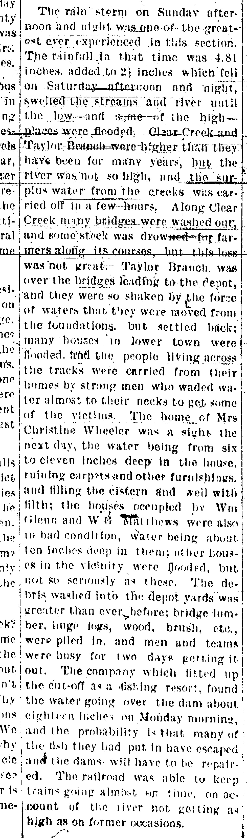
April 28, 1904 Argus
?? - taylor branch floods?
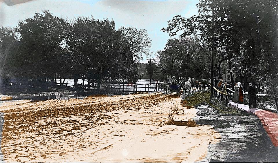
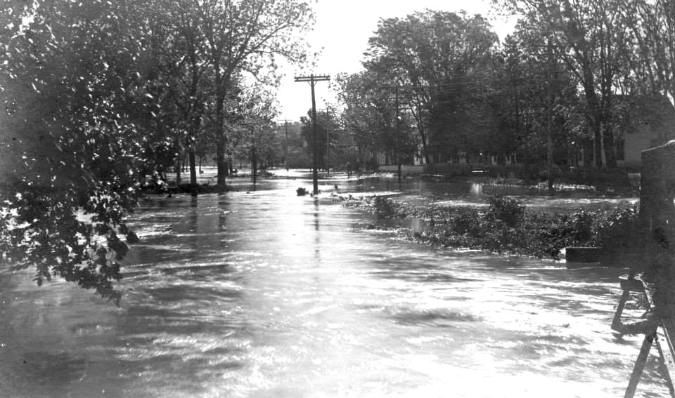
The photograph immediately above appears to show the approach to the bridge over Taylor Branch, looking east toward Lower town. The view of the bridge itself is obscured. You can see a telephone pole surrounded by water, and through the stand of the trees, if you magnify the view, you can see the windows of the house on the other side of the creek. There is no date. Was this taken in 1915? It's difficult to say; the trees are far more dense in this photograph, but it could be that then, as now, a century later, there were more trees on the west side. Or this is from an earlier time. The brick sidewalk is noteworthy. One ran around the Square and then down the hill to Lower Town and out to the depot. This is Photo 492, colorized by Steve Bixenmann.
1915 - taylor branch floods
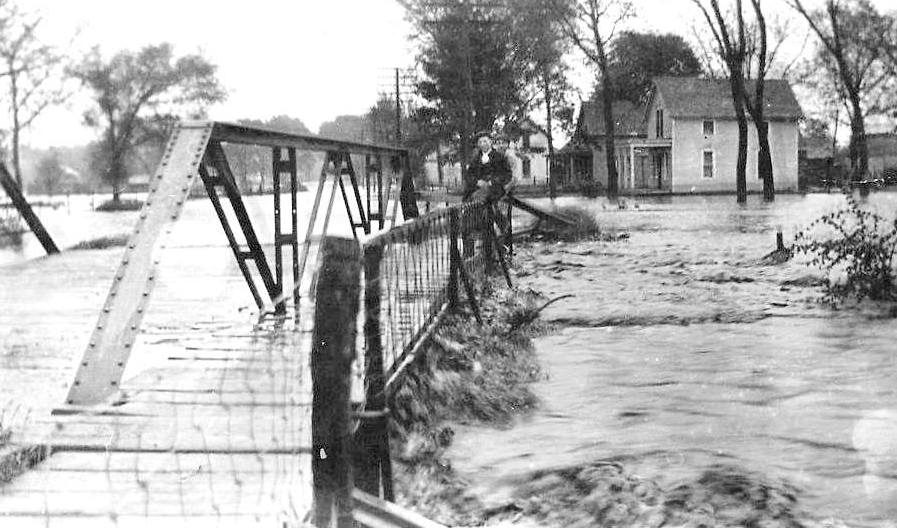
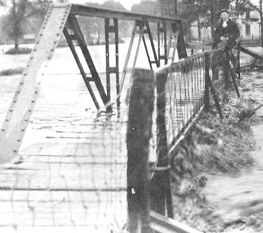
Photo 675, shared by Kim Vrtiska
Above -- the north side of the bridge is slightly visible to the right. Photo 424, shared by Kim Vrtiska.
1919 - Brick yard flooded "leaving a mass of smoldering ruins," bridge across taylor branch impassAble, "woodpiles and chickens" moved to safety
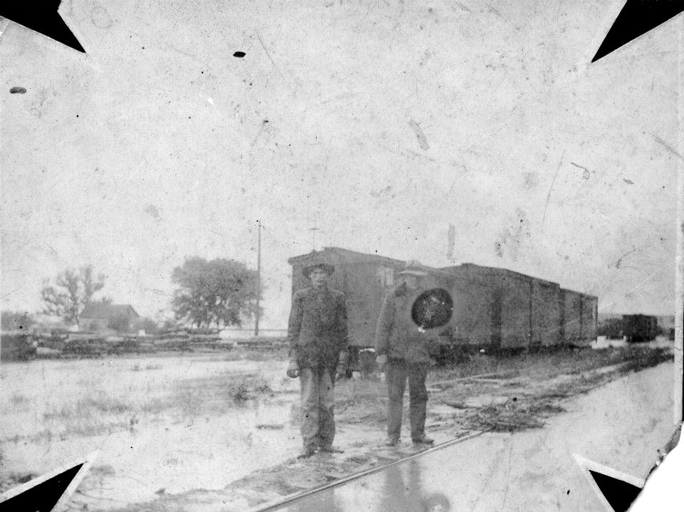
Photo 423 - Flood at the depot. Undated, but from the nature of the photo, it is pretty old, probably from before 1900, perhaps representing what the A&N was dealing with in 1898.
Dr. Mccrea DESCRIBES BEING CAUGHT IN A FLASH FLOOD AS HE DROVE HIS BUGGY BACK FROM A RURAL CALL.
FLOOD At the old mill site
Crops and enhancements bring out the details of the old mill that is partially in shadows in the original unretouched photo.
Probably the nemaha - but where & when?
Photo 4. There is no date. The back is marked Eva Linn, who probably owned the photo.
probably the nemaha -- but where and when?
Photo 425. This bridge appears to be the railroad bridge north of Table Rock, but the photo bears no annotation.
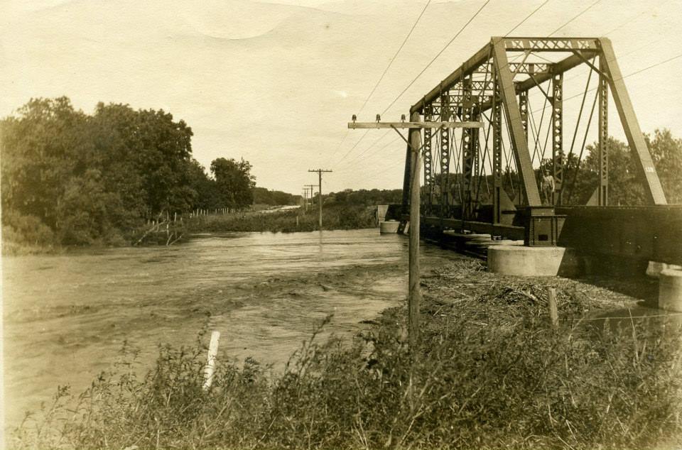
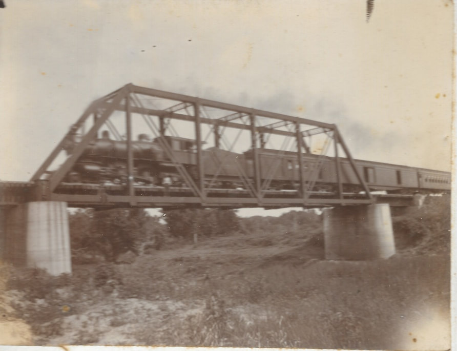
The following photograph (Photograph 869) is labeled as train crossing the Nemaha. Looking at the concrete pillars might lead one to think that it is the same bridge, i.e., the bridge above is the railroad bridge north of town. When the picture below was posted on Facebook, the surmise is that it was on the Nemaha 3-1/2 miles north of Table Rock.
floods - taylor branch
date unknown - probably before 1915
Photo 492. This is probably of the bridge into Lower Town. If so, it is probably before 1915; compare the bridge with the bridge in 1915, below.
Photo 492, colorized by Steve Bixenmann to aid in exploring the detail
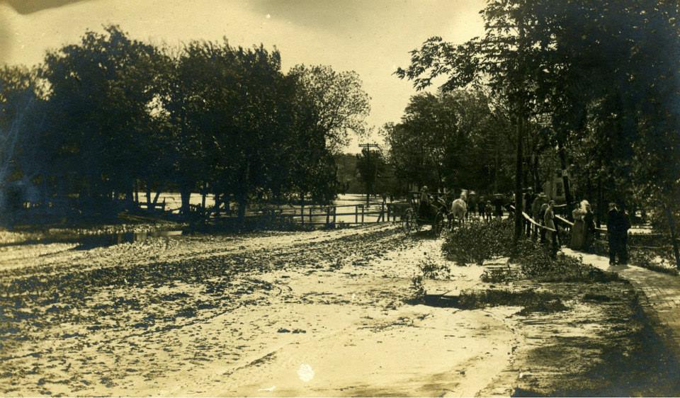
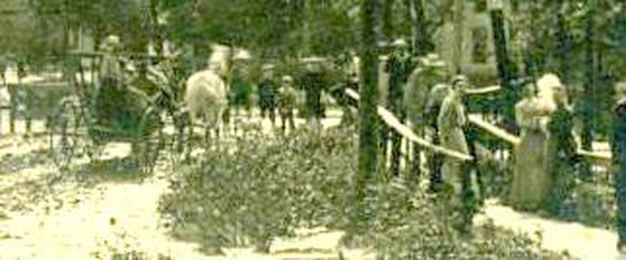
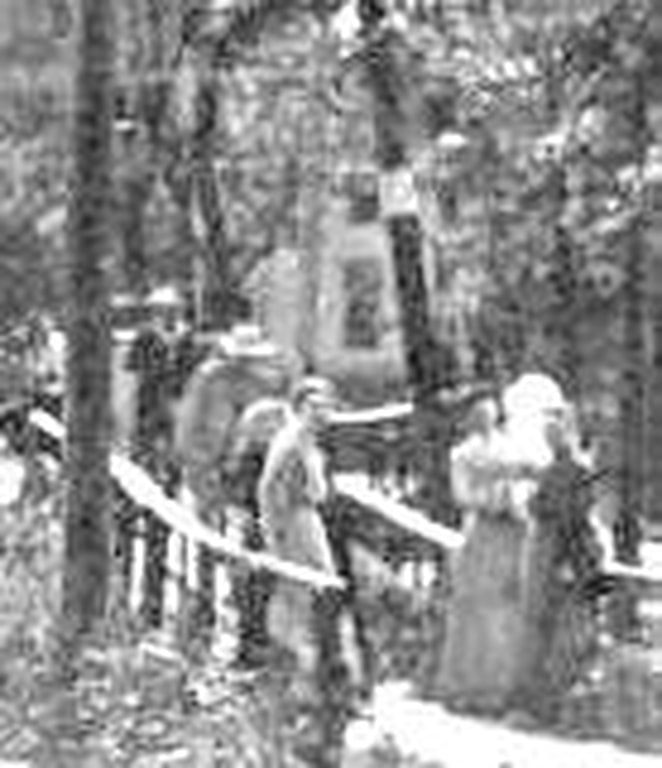
Details of Photo 492. Look at the bridge, the telephone pole on the north side of the road, and the house to the right in the trees, and compare to the 1915 flood picture below. It appears to be the same bridge, but an earlier time.
1915 flood
Photo 675 is identified as being in Lower Town 1915.
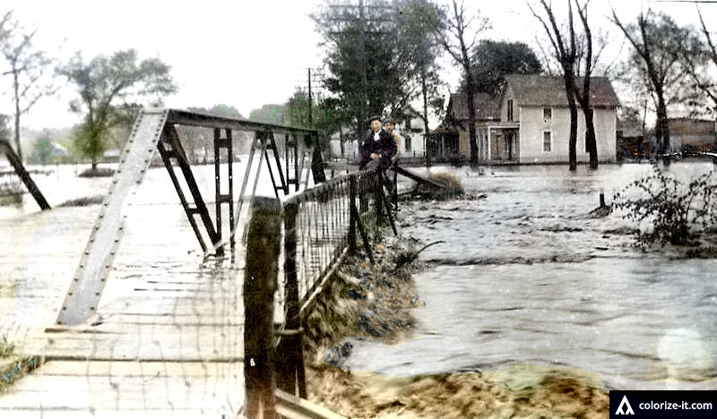
Photo 675, Colorized by Steve Bixenmann for an enhanced view

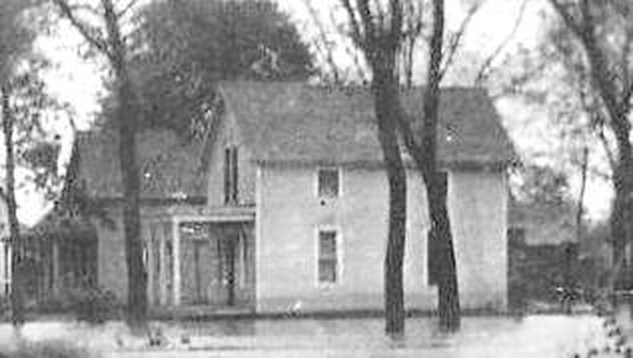
Here are excerpts of Photo 675 showing detais. The closest house is probably on the lot where Donnie Kalina now lives, which was built and lived in for many years by the Hillers. The Hillers built their house in about 1958.
Photo 424, the original and an excerpt, another view of the flood.
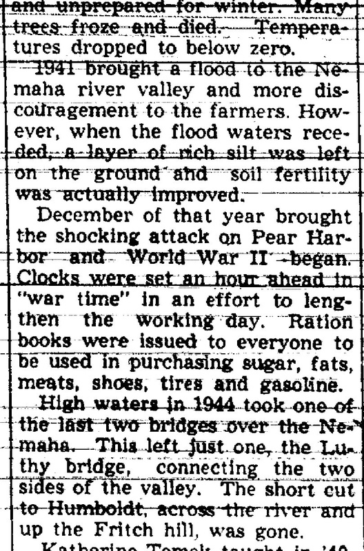
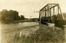
1941 and 1944. RICH SILT LEFT IN 1941, BRIDGE wiped out IN 1944