THE mills
This is a collection of information about mills in or relating to Table Rock. There were at least three. First was the "main" one on the Nemaha near "the Rocks." It was the earliest mill. Downstream was the Luthy Brothers mill. Finally, there is mention of a mill upstream called Libby's mill.
the luthy mills
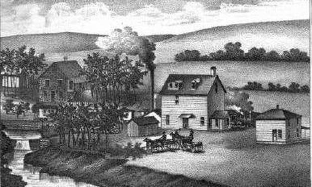
The mill built by the Luthy Brothers on the Nemaha, Eagle Mills. It was in section 12 of Sheridan Precinct. It is contained in the Biographical History of Johnson and Pawnee Counties, copies of which the Historical Society owns. In her little book, "Stories of Settlers on the Nemaha," Doralyn Cheny notes a reference to "the Luthy Mills:" which presumably were the same:"Luthy Mills were built by Mr. Simon Luthy in 1881 (Andreas, p. 1256). The mills were located in Section 12 of Sheridan Precinct—two miles south and two miles east of the Table Rock Mill. There is a drawing showing Luthy’s property in Chapman Brothers, page 440. "
If you would like more everyday instructions as to the location, this might work. Go to the old Reno Inn, down by the depot. Take the road that heads east, in front of the Reno, not the one that goes to the right, up the hill. The road at that point is called Railroad Avenue. Follow that road. Go for several miles, maybe even five miles. You will pass the old (and restored) Pleasant Valley Country School on your right, and almost immediately, the rock road swings to the left, and if you go straight you will find yourself on a dirt road. Follow that dirt road. It will swing to the right. Make the first turn to the left (east), which is a road leading to the river. The bridge is long gone. According to Junior Fritch (Rudy Fritch, Jr.), who grew up in the area and never left, the Luthy Mills were just upriver from where the bridge was.
Junior tells that when he was a kid, he did some work for "Mrs. Luthy," down where the mill used to be. She was an elderly woman, at least to his young eyes. She served dinner, and Junior says it was tasty. Included on the table was a dish of creamed nettles. Junior says that it was tasty, too. "I'd never heard of such a thing," he said, "But it was pretty good!"
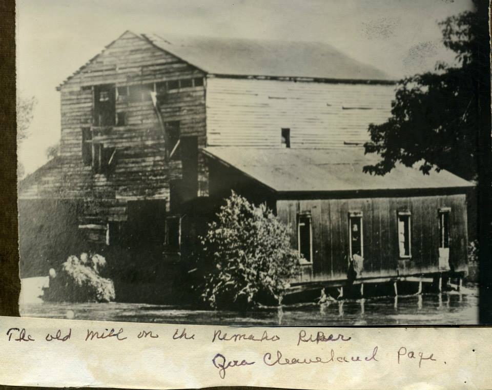
the earliest known photograph of the mill
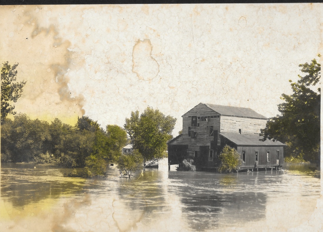
The mill had been abandoned by the time the earliest photograph was made in about 1908. Photo 1447, "The Old Mill by the Nemaha," by local professional photographer Archer King had colorized trees. The Nemaha appears to have been flooding.
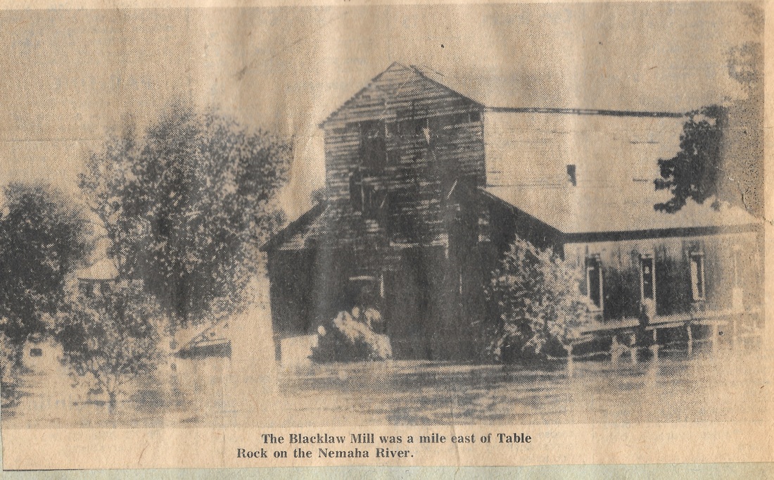
The Blacklaw Mill, in a clipping from the Argus. Photo 88.
Photograph of mill on the river. It seems to be an excerpt of the photo in the newspaper.
Photo 426, old mill on the river during flooding. Photograph from Kim Vrtiska, date unknown. Original very dark.
the FIRST mills
There is some confusion about the mills of Table Rock (not counting the Luthy Mills) because there were two. First, there was a "grist" mill (for grain) which eventually was upgraded to be a "flouring" mill. Then there was a sawmill. They were apparently at the same place but operated by different parties. Both mills were on the North Branch of the Big Nemaha River just below the rocks where the original Table Rock stood.
the grist mill
|
This narrative is based on sparse & conflicting information. It is only a starting point.
The stories below and others seem to indicate that a fine mill site was identified by the Table Rock Town Company as they started laying out the town in 1855. The land was owned by James Hinton,, although in 1856, John Tarbull bought a large piece of land which included the mills but it does not appear that he operated the grist mill. John Fleming was present in Table Rock in 1857 when the first families of the Nebraska Settlement Company arrived in early April 1857, because the memoirs of Juliana Gere describe the Flemings putting them up until the Geres could build their own cabin. No mention was made of the mill. The Flemings were building another home and moved out in late April. Fleming was operating it in early 1859, at least, because Lydia Griffing's memoirs for that year mention him. However, an 1859 article about a trip to Table Rock describes it as Hoadley & Muir's mill and mentions that the flouring machinery may be installed soon, so the date of the change of operator is uncertain. It was eventually operated by Cummings. Cummings' MIll had a tiny settlement around it (one or two stores, some houses, a grist mill, and a saw mill). Cummings sold it to Adam Clayton. Clayton's wife was killed in an accident at the mill in 1860. Clayton sold it to John Blacklaw. Blacklaw operated the mill for a while. The Andreas history notes, "John Blacklaw operated a water-power grist-mill, which has three run of buhrs." Mrs. Blacklaw's biography says that they bought the land in 1868, and this may be the date that they assumed operation of the mill. A Nebraska State Journal story in 1881 mentions that the :"wheel house" of Blacklaw's mill had been washed away, presumably a reference to the grist mill. Captain R. P. Jennings apparently bought it from Mrs. Blacklaw after Blacklaw was killed in a shooting accident, The mill was in operation in the 1850s and it reportedly operated until about 1900. |
the sawmill
|
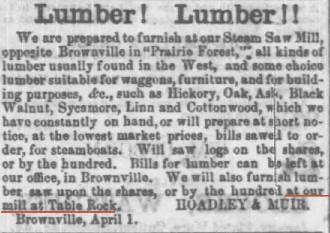
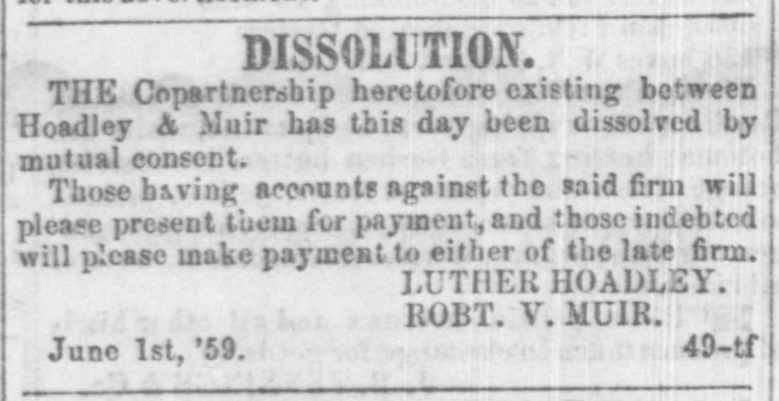
The sawmill is mentioned in early accounts, but it is unlikely that it operated for very long. Unknown persons built it, and it was bought by John Tarbull in about 1856. He sold it to Muir and Hoadley the next year. Muir was the treasurer of the Nebraska Settlement Company and would shortly after survey the "Original" Town of Table Rock (as opposed to the Railroad Addition of Table Rock or Peck's Addition, which is west of the Table Rock Cemetery.) The mill was in operation by Hoadley & Muir at the time of an 1859 story about a trip to Table Rock (which is elsewhere on this page) but by shortly after that the Hoadley & Muir partnership dissolved.
|
THE location of the TABLE ROCK MILLs
BY DORALYN STEINER CHENEY
In 1855, surveyors of Table Rock Precinct in their field notes described the rock formations from which Table Rock was to take its name. The notes indicated that the formations in the area we now know as "The Rocks" were located between sections 33 and 34. They then noted: “Below this about ⅛ of a mile is a fine mill seat on the Nehama.” (from Donald F. Danker’s article, “Founding of Table Rock” p. 39)
According to Joseph L. Edward’s Centennial History of Pawnee Co. (1876), James M. Hinton settled on the North Fork in 1854. Mr. Hinton “held the land now occupied by the Table Rock mill and owned by Mr. Blacklaw. He first projected the mill, ultimately erected by other parties, and afterwards sold out to John Tarbull, who arrived here in 1855 (p. 8).
In 1856, when a site for the county seat was going to be selected, “John Tarbull came into possession of the quarter section upon which the Table Rock Mills is located, and he together with L.G. Jenkins contrived to divert considerable support to a point on this quarter on the high ground across the Nehama, east of the mill site” (p. 9-10).
In 1857, “The Table Rock saw-mill (water), under ownership of Muir & Hoadly, began work in the fall of this year, having bought Tarbull out in the spring. Mr. M.J. Mumford did the first sawing in the mill” (p. 17).
R. V. Muir was the treasurer of the Nebraska Settlement Company. “Giddings and Muir, as agents for the Nebraska Settlement Company, purchased the interests to the Table Rock Townsite Company in 1857” (Danker, p.39). Evidently, the mill site was bought privately around that time by Mr. Muir (and others).
Juliana Gere wrote in her account of 1857, “Mr. Davison left and worked on Mr. Muir’s mill and also Mr. Westfall” (fifth page). On July 18, 1858, she wrote, “Mill dams washed out and it will take many hundred dollars and much time to repair the damage.”
According to Lydia Griffing, “In 1859 there was a [grist] mill at Table Rock. That year there was no wheat nor flour to be bought. Our obliging Table Rock miller, Mr. Fleming, bolted our meal for us.”
According to Fannie Norris, “It was about the third year we were here that the old mill was built down by the Nemaha.” (The 90-year-old Fannie was sometimes off on dates by a year or two.) She probably was referring to the mill that replaced the one that was washed out in 1858, less than two months after she arrived in Table Rock.
An article about Mrs. Margaret Blacklaw in Chapman Brothers’ Portrait and Biographical Album of Johnson & Pawnee Counties Nebraska, stated that “she owns a valuable farm, lying mostly on section 34” of Table Rock Precinct (page 560). She and her late husband bought the farm in 1868. “The Table Rock mill on the farm had then a large trade” (page 561).
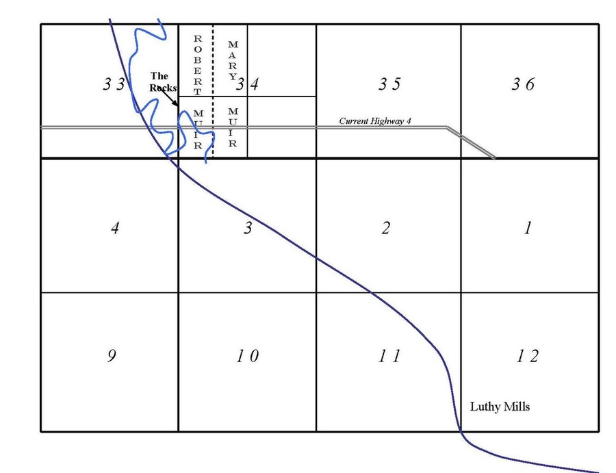
I have looked in the land patents database of the General Land Office Records of the Bureau of Land Management. It shows the initial owners of record. I find the name of Robert V. Muir with others for the W½SW¼ and W½NW¼ of Section 34 and the name of Mary Muir with others for the E½SW¼ and E½NW¼ of Section 34 (T3N, R12E). The other names include Luther Hoadley shown as a warrantee under Mary’s name.
Most likely the Table Rock Mill was located in the W½ of the SW¼ of Section 34.
From a 1917 historical map of Table Rock Precinct I have added a rough sketch of the Nehama River in Sections 33 and 34 to a plat of the area. A sketch of the current channel is shown in dark blue.
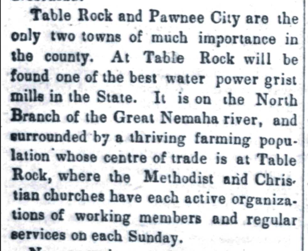
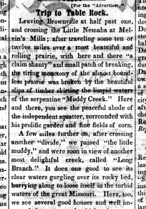
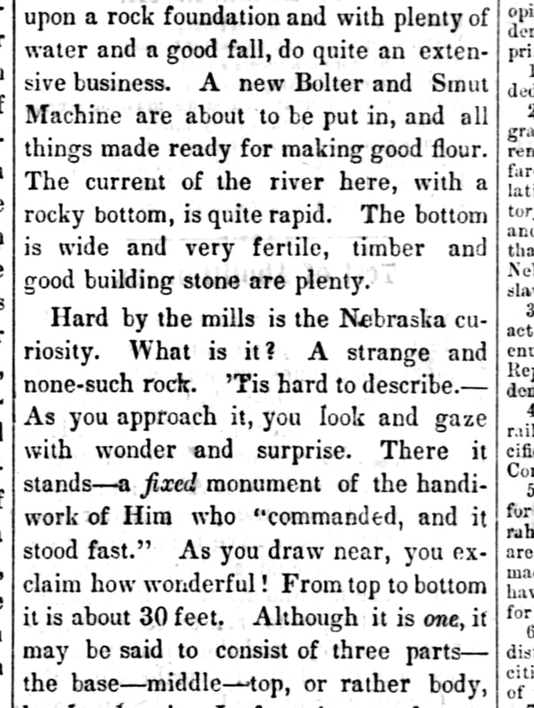
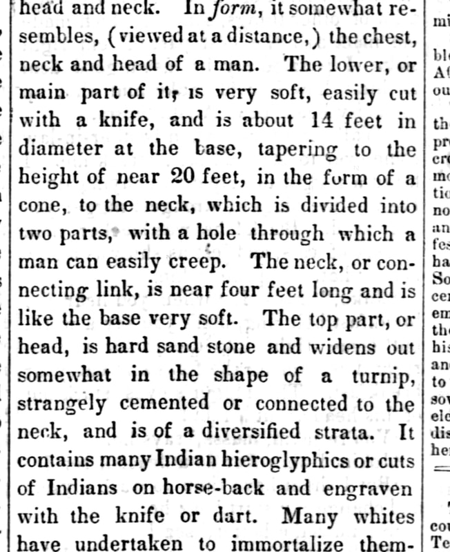
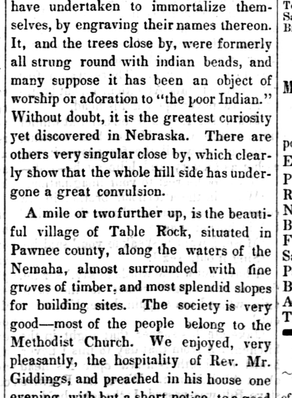
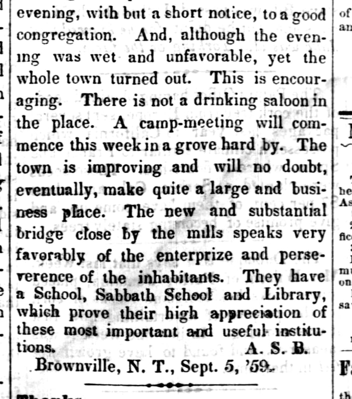
an 1859 account of a trip to table rock from brownville that includes a description of the mills
The narrator describes a day of traveling from Brownville on a trip that began at 1:30 p.m. and adventures along the way. Then:
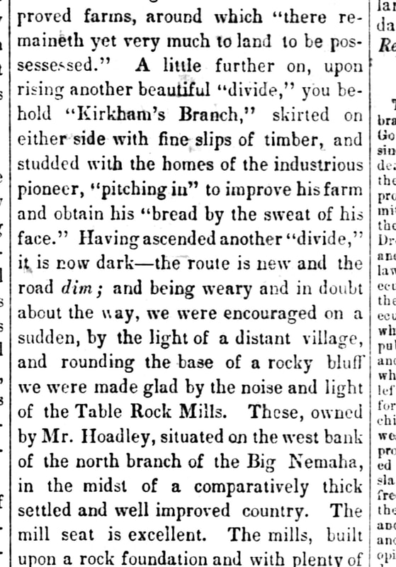
Having ascended another "divide" it is now dark -- the route is new and the road dim; and being weary and in doubt about the way, we were encouraged on a sudden by the light of a distant village, and rounding the base of a rocky bluff we were made glad by the noise and light of the Table Rock Mills....
From the September 15, 1859 Nebraska Advertiser newspaper of Brownville, Nebraska:
an 1861 newspaper article
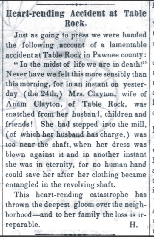
The July 25, 1861 Nebraska Advertiser reported an accident that has faded in Table Rock lore. Some have heard that it was the miller's wife who was killed at the mill who is buried under the mysterious tombstone in the Table Rock Cemetery, but that stone bears the date of 1858. The accident is cited and miscited as to when it happened and the name of the unfortunate miller's wife, but this newspaper article is a "primary source" and therefore the most reliable.
excerpts from 1933 ORAL HISTORY
|
tHESE HISTORIES ESTABLISH THAT THE MILL WAS IN CLOSE PROXIMITY TO THE ROCKS AT GOAT HILL, THAT THERE WAs A DAm and A MILL POND, AND MORE.
In 1933, Elsie Pepoon Sutton interviewed people about their memories of the original Table rock. In the course of her interviews, she also gathered local history about other matters. They included the following:
Elsie interviewed John R. Allen, born in 1846, was 87 in 1933. He came to Long Branch in 1865 but moved to the Howe farm in the Bunker Hill neighborhood in the fall of 1866. [The history establishes that the Table Rock fell no later than 1869.] One day when he was young, he and his brother sawn some Indians and followed them, he on a mule and his brother on a horse. They followed them to a place near the rocks (of what is now referred to as Goat Hill). They found pictures on the rocks and also "on the sandstone above the dam. A great many rocks were thrown into the mill dam, to make the dam" and he suspected they had pictures on them too. Allen also said that his father taught school in the back room of Charlie Libby's house "up by Libby's mill."
Thus, Allen's account suggests that the mill and the rocks were in close proximity -- why how would rocks for the dam for the mill pond have been brought any great distance rather than taken from the lime stone rocks on the side of what is now called Goat Hill. There is also a reference to a mill, presumably upstream, called Libby's Mill. (Libby was one of the early residents of Bunker Hill, which is upstream.)
Mrs. Fannie Norris, age 92 in 1933. She "told of the death of Mrs. Clayton, the wife of the miller, who was killed in the mill. Her dress caught in the machinery."
Thus, Mrs. Norris's memory, at least as of age 92, is that at one point the mill was owned by a man named Clayton and that his wife suffered a fatal accident at the mill.
Gabriel Morton, born in 1850, age 83 in 1933. He described playing at the mill when young, which would probably place the time as the early 1860s at most. "There was a boy about my age, John Clayton, the son of Miller Clayton. I used to play with him all over those hills and around those rocks. And there weren't many boys in the country then to play with. Yes, it was his mother who was killed in the mill. I remember coming down to the mill and to the mill pond. That looked like a good place for a swim, for I always liked to swim, so I went swimming in the mill pond. Then John Clayton and I went on up to the rocks. That was the first time I saw it," the Table Rock.
Thus, Gabriel Morton's account establishes that in the early 1860s the mill was owned by a man named Clayton, and that the mill and "the" Table Rock were physically close. The boys swam in the mill pond and then went up on the rocks.
Percy Pepoon, then of St. Louis, Missouri, age not mentioned. He described the Table Rock in relation to the mill, which he referred to as Cummings Mill. "I first saw in the rock in the summer of 1869. We had gone to mill at Cummings' (after Blacklaw's mill). The Nemaha was high and we could't get across. We found ourselves in the midst of a cap of about two dozen immigrant families, waiting for the river to fall so they could continue their trek to the free lands. We waited there while my father in some way crossed the river, and I made my way around to the Rock." "Cummings' mill was a busy as well as picturesque spot. Dr. Gandy had his lair there, there was a store or two, a saw mill, and a number of houses. People brought their grists from long distances. They also brought huge cottonwood logs to be sawed into lumber, and there was the flow of homesteaders westward. Cummings held forth to all and sundry about the coming great city to surround his mill site."
Thus, Percy Pepoon's account establishes a number of things. First, Cummings' mill was a small complex, with not only the grist mill that people traveled long distances to use, but also a sawmill, a store or two, and a number of houses. Second, his account seems to reflect that the mill itself was on the other side of the river from the Table Rock, unlike the accounts of the others above who went straight from the mill to the rocks. In Percy's account, the Nemaha was high and his father had to cross it to get to the mill, whilst Percy explored the rocks. Given that the immigrant families waiting for the river to fall were almost certainly heading west, that would put the mill on the west side of the Nemaha and the rocks on the east. Of course, what was the course of the river in 1869. Had it changed from earlier days? It hardly seems likely. This is a small mystery.
the mill stone in the table rock square
A 1939 newspaper article with a little history about the mills
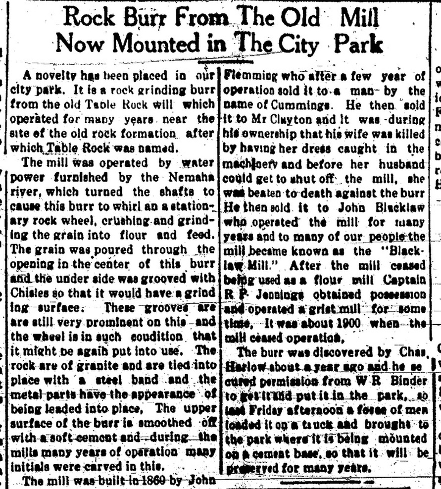
A December 4, 1939 article reports that the millstone was placed in the Square. This article tells the history of the mill, which it says was built in 1869 by John Flemming, who sold it to a man named Cummings, who sold it to a man named Clayton who, after her wife was killed in the mill after her dress was caught in the machinery sold it to John Blacklaw. After Blacklaw stopped using it as a flour mill, Captain R. P. Jennings used it as a grist mill. He ceased operations in 1900. Charles Harlow discovered it in 1939, apparently on the land of W. R. Binder, who gave him permission to take it and put it in the park.
The article may have erred in saying that the mill was built in 1869, given the oral history accounts collected by Elsie Pepoon above about events prior to 1869. By then the mill, built here by Flemming it says, was already in Cummings' hands, yet the article says that Fleming sold it to Cumings a few years after he built it.
The article may have erred in saying that the mill was built in 1869, given the oral history accounts collected by Elsie Pepoon above about events prior to 1869. By then the mill, built here by Flemming it says, was already in Cummings' hands, yet the article says that Fleming sold it to Cumings a few years after he built it.
Here are photographs of the millstone taken in June 2015. One side of the stone has been protected by a coating of cement, and a metal band around its perimeter likewise has been added. These photographs show the cement side, and a view inside a notch on the cement side. On the side showing the actual stone photographs include the original hub in several views; the fastener deep inside the hub is is presumably not original. There is a plaque placed in 1998. It refers only to the Blacklaws; they seem to have been the most widely-known of the various owners.
a history written in 1957 by nettie stehlik says, probably inaccurately, that the first mill built in 1878
|
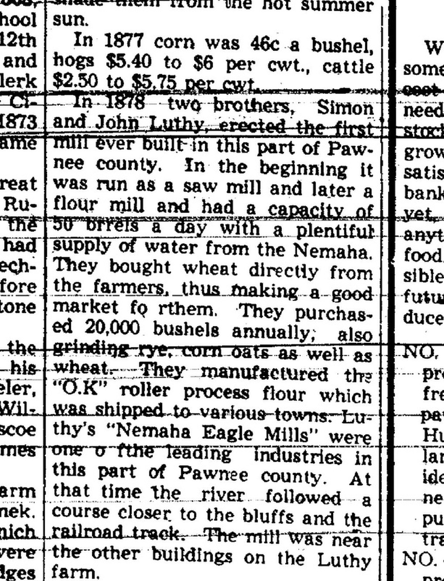
This is an excerpt from a July 4, 1957 article about the history of Pleasant Valley School, District 32. It is one of a continuing series that began on June 27, 1957. It says that the mill was built in 1878 by two Luthy Brothers, being run first as a flour mill and then as a saw mill. It says that this was the first mill. This is inconsistent with all of the accounts above. It is likely that the Luthy Brothers built their mill in 1878, but it was not the first.
Nettie's history is extremely detailed and a wonderful portrait of the times; it may be that she did not have all of the information about the mill as she wrote her extensive and comprehensive history. |
Regardless of whether the Luthy mill was the first mill, Nettie's history is a wondrous must-read history of the early times:
|
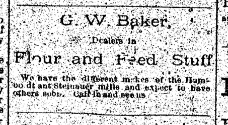
This February 3, 1893 ad from the Argus refers to "flour and feed stuff" from the Humboldt and Steinauer mills, but does not mention Table Rock.
Pioneers came from long distances to have their grain
ground at the grist mill in Table Rock.
|
Here are the recollections of a pioneer wife in Marshal County, Kansas (southwest of here), which include her husband making the journey to the mill in Table Rock. She says it took him four to five days. I'm not sure exactly where she was in Marshal County, but I estimate that it was probably a 50 mile trip by horse and wagon. This letter is from Emma Forter's History of Marshall County, Kansas (1917): LETTER FROM MRS. GEORGE W. THORNE. Beattie, Kansas February 14, 1917 Dear Mrs. Forter: Replying to your request to tell you something of old times: I came here from Maryville, Missouri, where I had three months schooling, before coming to Kansas with my father, Joseph Totten. There were six children in our family. There were no schools to go to here and there were more Indians than white people. Mrs. Emma Jones, formerly Totten, taught the first school in our district. We had to have three months school taught before we could draw any state money. My brother, John Totten, and Frank Lannan went to Blue Rapids and paid tuition for three months school. Soon after the neighbors got together and organized a district named Guittard, and then they had three months more school. But three months school was all I ever had. Yes, I plowed five acres of ground with an ox team. The boys helped plant the corn. We then had to harvest with an ox team. In 1860 I was married to George W. Thorne and we went on a farm where we lived five years. There was only one house between here and Marysville and that was a ranch kept for the traveler. I remember one night I started after my father who had gone on foot to Marysville after the doctor and I met him about halfway. My father used to go to St. Jo for provisions and once he brought out two cats, for which he paid a dollar apiece in St. Jo. If we had a calico dress, it was good enough for church or dances. And if I wanted a new dress I would go and drop corn for fifteen cents a day and earn the money for the dress. To obtain the first feather bed I had, I husked corn for fifty cents a day for my father and paid him one dollar apiece for the geese to get feathers to make the bed. When I was married, I had a home-made table, three stools and a cottonwood bedstead that Mr. Thorne made and I cooked over a fire-place. I dropped ten acres of corn in one day and had three cows to milk. I have husked more corn than half of the farmers raised last year. After we got to raising corn to sell, my husband used to haul it to Ft. Kearney, where he sold it for one dollar a bushel and we could only get ten or eleven cents a bushel in Marysville. We knew nothing of corn shellers and once shelled forty bushels by hand. My husband used to go to St. Jo with an ox team for groceries and meat. That was our nearest meat market. The first wheat we raised was three acres and there came a prairie fire and burned it up. When we raised wheat my husband cut it with a cradle and I bound it with straw and we threshed it with a flail. We had to take it to Table Rock, Nebraska, to mill, which took four or five days and I had to stay at home and do the chores. There were plenty of Indians around, too, with whiskey to drink. If I wanted to go and visit a neighbor I would walk four or five miles and stay all night and come home the next day. When we wanted to write to a friend, we had to go to the hen house, get a quill to make a pen and make ink out of maple bark. My family consisted of ten girls and one son, George W. Thorne, of Beattie. Ten of our children graduated from the Beattie schools. I am now seventy-one years old. With best wishes, ELIZABETH THORNE EARLY SETTLER'S DEATH Mrs. Elizabeth Thorne died on Tuesday, April 17, 1917, and was buried Thursday afternoon, April 19. She was seventy-one years, six months and nine days old. She had been a resident of Marshall county since 1858. She was a daughter of Joseph Totten, one of the pioneers of Marshall county. Her husband, George W. Thorne, deceased, was another of the pioneers of Marshall county. Mrs. Thorne was a splendid woman, kind, generous, faithful and true. Her influence in the community was always for the good and for the advancement of the things which went for community betterment. Mrs. Thorne was present at the pioneers' reunion at Marysville last fall and registered on the roll of old settlers. Only a very few enrolled who antedated her in residence in Marshall county. The last writing Mrs. Thorne did was the foregoing sketch for this History of Marshall County. |
ADVERTISEMENTS
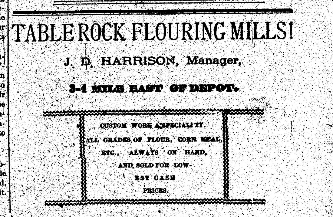
December 2, 1882 ad for Table Rock Flouring Mills.
|
By the way, most fingers pointed at J.D. Harrison as the man who destroyed Mushroom Rock. See Elsie Pepoon Sutton's History of the Original Table Rock.
|
the story of another grist mill,
with explanation of how it worked
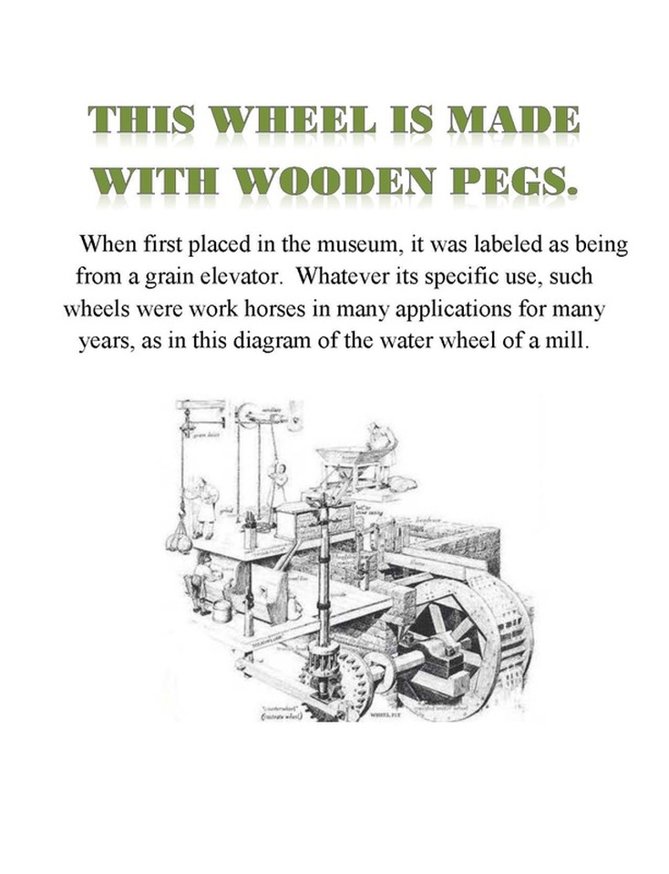
At about 2 minutes 30 seconds you can watch a still-operating grist/flouring mill that was built in 1860. The one in Table Rock was not as grand as this one, although judging from the pictures of it after abandonment, it was a good-sized structure.
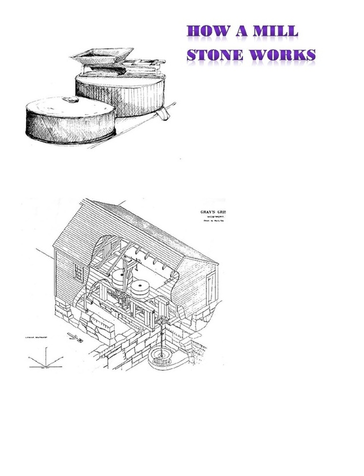
how a grist mill stone works
a patent for mills
|
A patent for mills. Rudolph Vrtiska and William Philpot of Humboldt secured a patent in 1909 for metal splines to go between floor boards to facilitate the use of shovels without wearing the floor boards. Quentin Fankhauser found this. Humboldt's mills have been an institution.
The photograph is a postcard of the Humboldt Mill, front and page. It is difficulty to read the date, but it is a 1 cent stamp. Postcards were 1 cent from 1872 to 1917, and from 1919 to 1952, so that isn't much of a clue. |
|
